


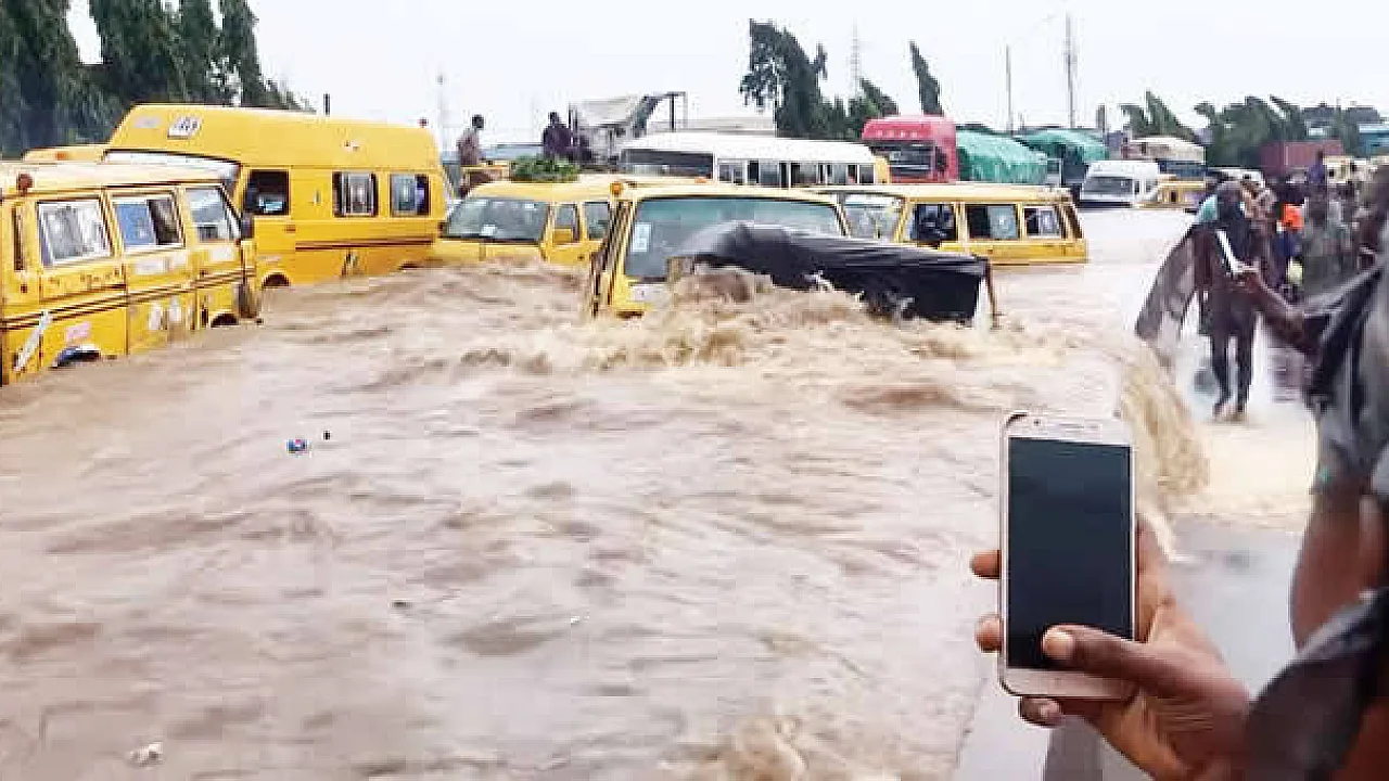
The Federal Government has issued a fresh flood warning for 15 Nigerian states, with more than 8,000 communities and 4,500 schools exposed to possible flooding between September 19 and 25, 2026.
The Nigeria Hydrological Services Agency (NIHSA) warned that rising river levels could cause flooding in vulnerable communities, putting homes, schools, healthcare facilities, markets, farmlands and religious buildings at risk.
The affected states are Lagos, Rivers, Imo, Cross River, Ebonyi, Benue, Anambra, Akwa Ibom, Edo, Kogi, Taraba, Delta, Bayelsa, Enugu and Abia.
The warning comes as residents in several parts of Nigeria continue to face the threat of flooding during the rainy season, raising concerns about the safety of communities located near rivers and other flood-prone areas.
According to NIHSA, the latest National Flood Advisory covers a seven-day period from Saturday, September 19, to Friday, September 25.
The agency's Director-General and Chief Executive Officer, Umar Mohammed, said rising river levels could lead to flooding in vulnerable locations, urging state governments and local authorities to take immediate preventive measures.
Mohammed advised residents living in flood-prone communities to prepare to move to safer and higher ground where necessary rather than wait until floodwater enters their homes.
The agency also called on state emergency management authorities, local government councils, traditional rulers and community leaders to strengthen early-warning systems and assist residents who may need to relocate.
Cross River, Ebonyi, Imo and Anambra are among the states where the agency identified large numbers of communities and public facilities exposed to possible flooding.
In Cross River State, NIHSA identified 2,471 communities, 703 schools, 344 healthcare facilities, 145 markets and 453 religious buildings within areas exposed to the forecast flood risk.
The affected local government areas include Abi, Akamkpa, Akpabuyo, Biase, Calabar, Calabar South, Ikom and Obubra.
The agency also identified 854 hectares of farmland exposed to possible flooding in the state, raising concerns for farmers and residents whose livelihoods depend on agricultural activities.
In Ebonyi State, 2,574 communities and 1,064 schools were identified as vulnerable, alongside 422 healthcare facilities, 480 markets and 629 religious buildings.
The affected local government areas include Abakaliki, Afikpo, Afikpo South, Ebonyi, Ezza North and Ezza South.
NIHSA also identified 1,882 hectares of farmland in the state's flood-risk assessment.
In Imo State, the agency listed 958 communities, 1,022 schools, 553 healthcare facilities, 161 markets and 198 religious buildings as exposed.
The vulnerable local government areas include Aboh-Mbaise, Ahiazu-Mbaise, Ehime Mbano, Ezinihitte, Ideato North, Ihitte/Uboma and Ikeduru.
Anambra State was also identified as a major area of concern, with 1,314 communities, 1,308 schools and 1,089 healthcare facilities exposed to possible flooding.
The affected local government areas include Aguata, Anambra East, Anambra West, Anaocha, Awka North, Awka South and Ayamelum.
The agency further identified 280 markets, 610 religious buildings and 1,529 hectares of farmland within the exposed areas in Anambra.
In Benue State, the vulnerable local government areas include Buruku, Gboko, Guma, Katsina-Ala, Logo and Ukum.
NIHSA identified 303 communities, 100 schools, 48 healthcare facilities and 32 markets as exposed to possible flooding in the state.
For Akwa Ibom, affected local government areas include Abak, Eket, Etinan, Ibeno, Ibesikpo Asutan, Ibiono Ibom, Ika and Ikono.
The agency identified 249 communities, 323 schools, 211 healthcare facilities, 74 markets and 289 religious buildings as exposed to flood risk in the state.
Although Lagos, Rivers, Edo, Kogi, Taraba, Delta, Bayelsa, Enugu and Abia are also included in the national warning, the advisory does not mean that every community in those states will experience flooding.
The warning identifies areas exposed to possible flooding, not locations where flooding has already been confirmed.
NIHSA said nine river monitoring stations required close attention, including Obubra, Itigidi and Epento along the Cross River.
The agency urged communities located on floodplains to monitor official warnings and move people, livestock and important belongings to safer ground where necessary.
Residents were also advised to avoid crossing flooded roads, bridges and fast-moving water, whether on foot or in vehicles.
State and local authorities were encouraged to identify safe shelters for possible temporary evacuation and prepare essential supplies, including drinking water, water-treatment materials, relief items and first-aid equipment.
The agency also called for the clearing of blocked drainage channels and river outlets where it is safe to do so, while warning against continued settlement and construction in vulnerable floodplain areas.
The latest warning comes amid wider concerns about Nigeria's recurring flood disasters.
Earlier in September, the National Emergency Management Agency disclosed that NIHSA's 2026 Annual Flood Outlook had identified 14,118 communities across 266 local government areas in 33 states and the Federal Capital Territory as being at high risk of flooding during the year.
The new September 19 to 25 warning is a shorter-term advisory identifying areas exposed to possible flooding during the specified seven-day period.
For residents of the 15 affected states, the immediate concern is whether their homes, schools, workplaces or communities are located in vulnerable areas.
Those living near rivers and floodplains have been advised to follow official updates, pay attention to local evacuation instructions and avoid travelling through flooded areas.
NIHSA said it would continue monitoring river levels and hydrological conditions across the affected states and issue further warnings where necessary.
With the advisory remaining in effect until September 25, residents in vulnerable communities have been urged to take precautions before rising floodwater makes movement or evacuation difficult.


Comments (0)
Leave a Comment
No comments yet. Be the first to share your thoughts.